Manaslu,
the old salt route to Tibet
Glacial passes, ancient monasteries, and a valley that still guards its secrets
The Manaslu Circuit circles the eighth‑highest mountain in the world, threading through deep river gorges, Tibetan‑influenced villages, and the formidable Larkya Pass at over 5,100 metres. For centuries this was a caravan route carrying salt between Nepal and Tibet, and it still carries that sense of slow, borderland journeying. For a photographer, the valley offers a rare combination of raw Himalayan scale and intimate cultural detail — fewer trekkers, more silence, and a landscape that changes personality every few kilometres.
The Manaslu Circuit: Soti Khola to Dharapani
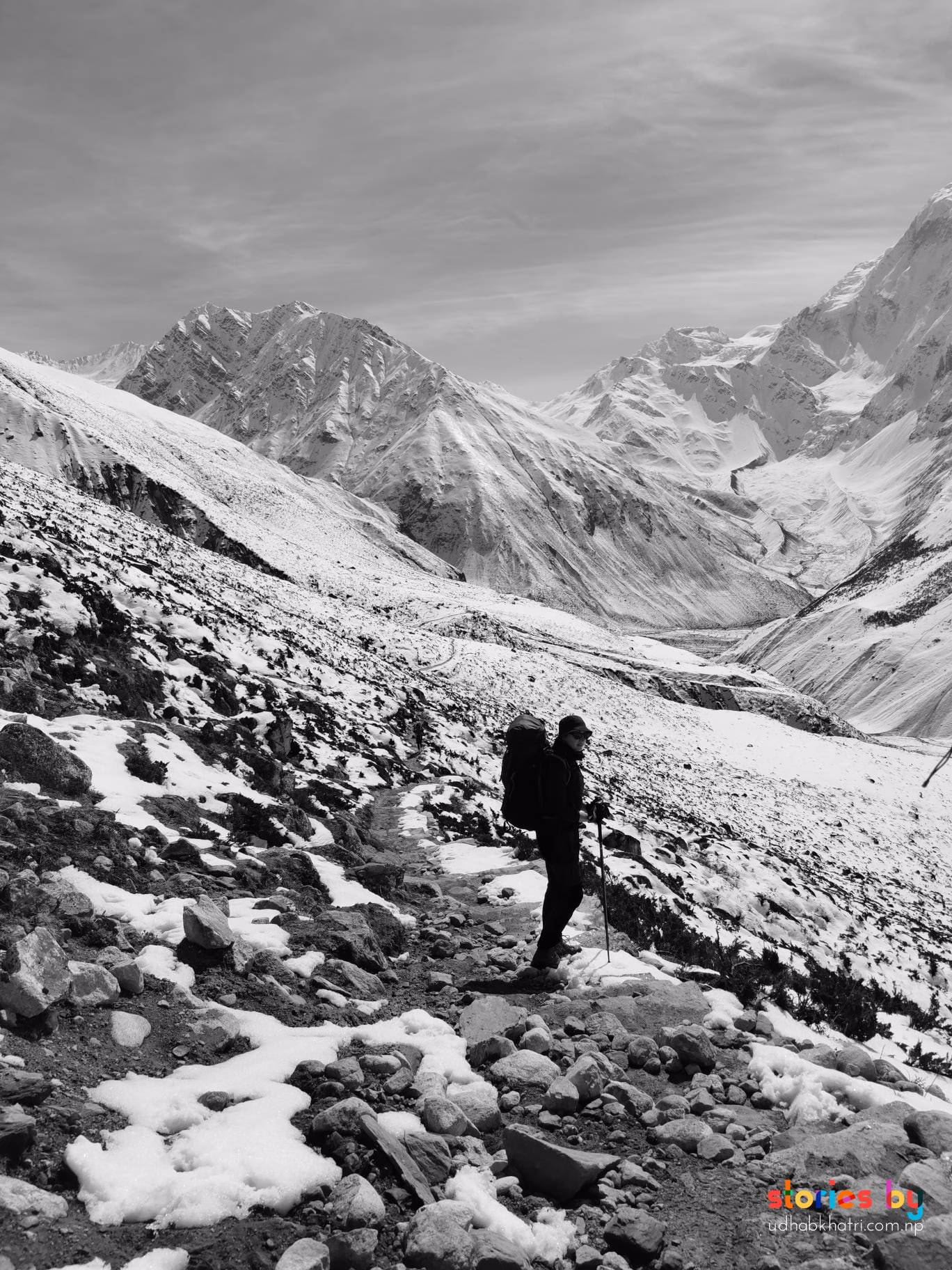
The trek begins at Soti Khola, after a long jeep ride from Kathmandu. The first days ascend gradually through the Budhi Gandaki river valley, past rice fields and Gurung villages. The landscape shifts quickly — pine forests, suspension bridges, and narrow gorges give way to drier, more open terrain as you climb. Tibetan influence becomes visible in the monasteries, prayer flags, and chortens that dot the path. Villages like Samagaon and Samdo are ideal places to spend an acclimatisation day, and the side hike to Manaslu Base Camp or the glacial lake at Birendra Tal is well worth the effort.
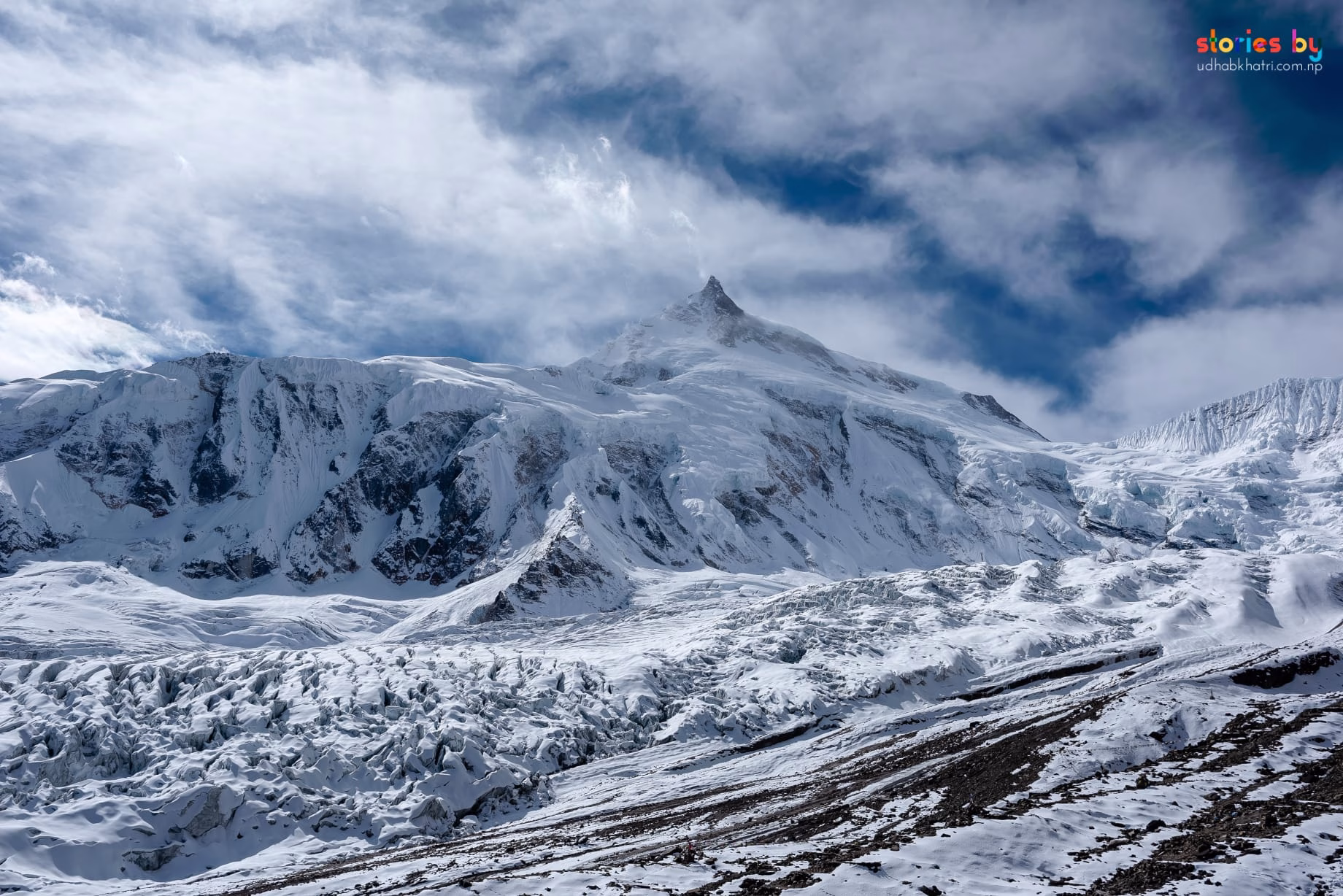
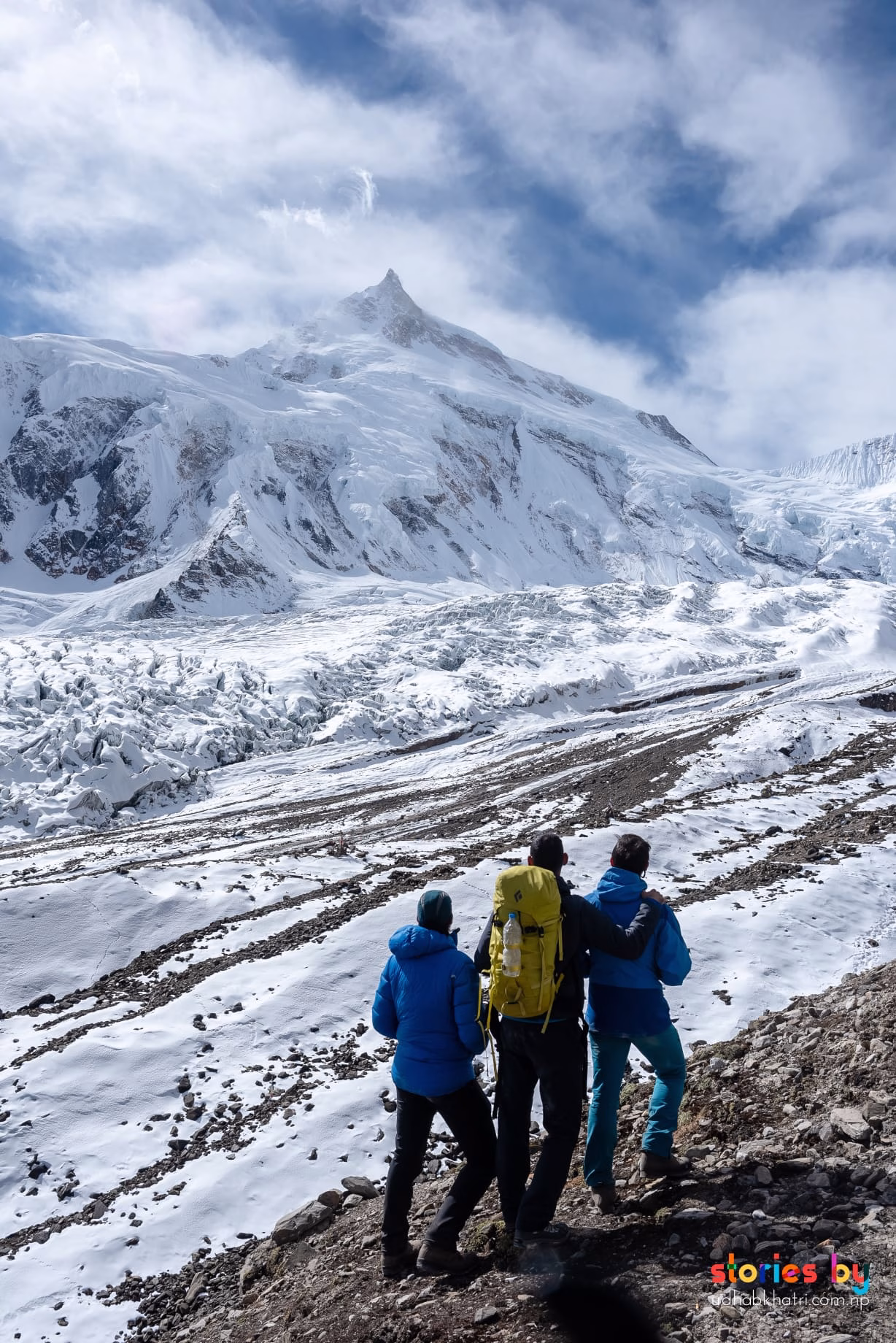
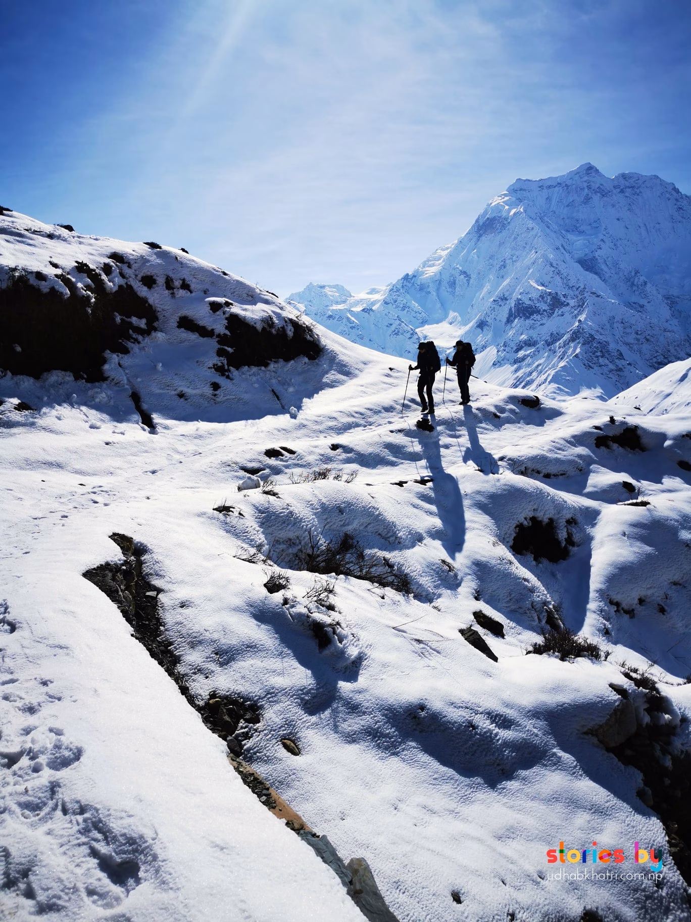
The climax is the crossing of Larkya La (5,160 m), a high‑altitude pass surrounded by glaciers and snow‑covered peaks. The ascent starts well before dawn; the light at first is cold and blue, then golden as the sun hits the ice. From the top, the panorama stretches across the Manaslu range and into the Annapurnas. The descent into the Marsyangdi valley connects to the Annapurna Circuit at Dharapani, where the trek officially ends.
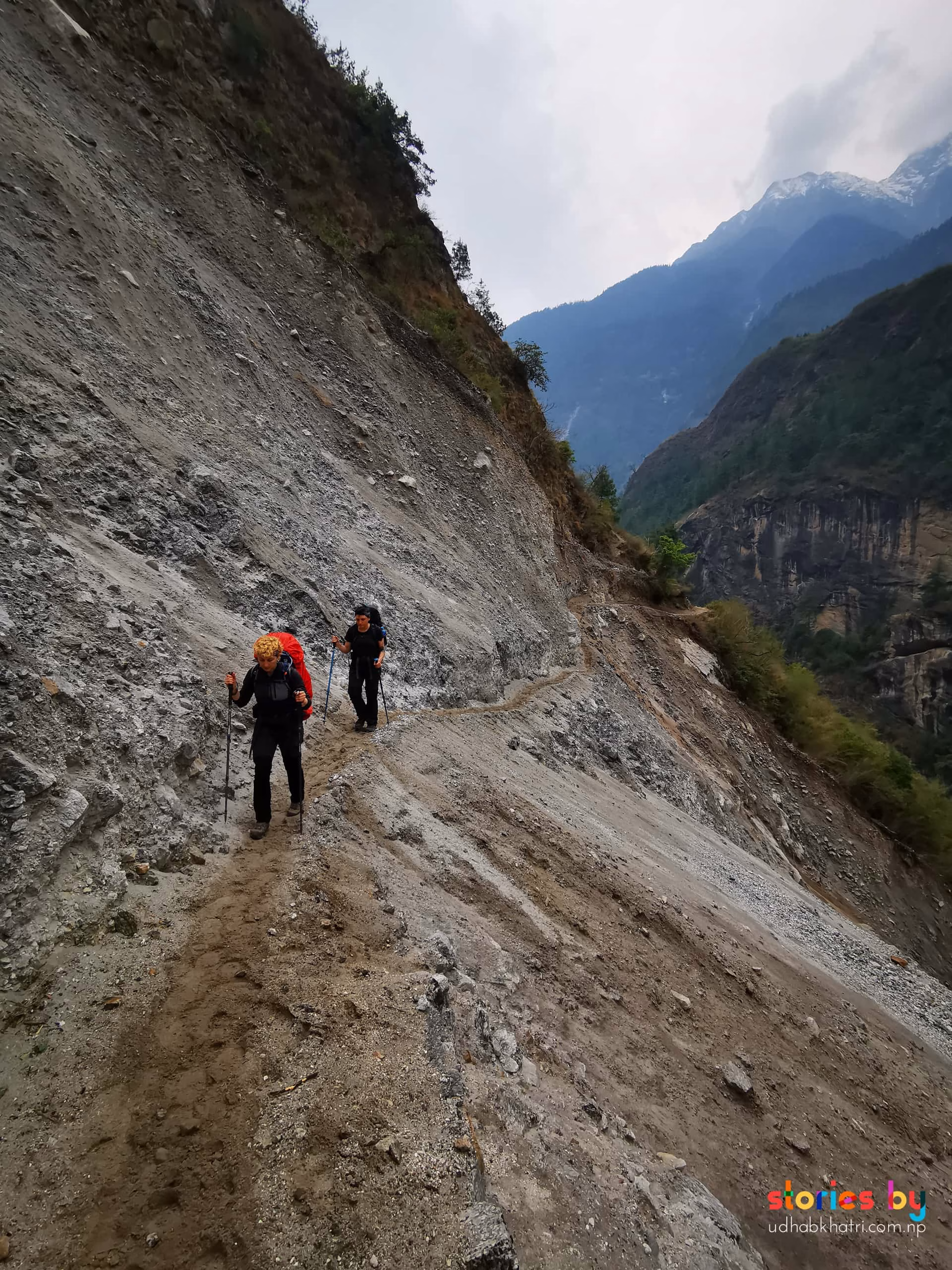
⚠️ Landslide danger: Several sections, especially between Jagat and Deng, are prone to rockfall and landslides, particularly after rain. Listen to your guide, do not linger in active zones, and cross quickly when instructed.
The lower gorge is dark and dramatic; a 24‑70mm zoom handles the changing light. As the valley opens, switch to a telephoto (70‑200mm) to compress the villages against the mountain backdrop. Samagaon and Samdo offer some of the best cultural portraits on the circuit — the morning light on the monastery and the prayer flags is exceptional.
The pre‑dawn ascent is an opportunity for atmospheric, high‑ISO work: headlamps snaking up the trail, the first light on the peaks. At the pass itself, a wide‑angle (16‑35mm) captures the scale of the surrounding ice and rock. Protect your batteries from the cold — keep a spare inside your jacket. The descent into the Marsyangdi side is less photographed; the light in the late morning can be harsh, but the changing vegetation and the sudden return to green after days of arid terrain is a visual story worth documenting.
 Photo
Photo
 Photo
Photo
 Photo
Photo
 Photo
Photo
The Manaslu Circuit is a restricted area: a registered guide is mandatory, and you must travel in a group of at least two. Independent trekking is not permitted. This regulation, far from being a burden, helps preserve the valley's wild character and intact culture.
Tsum Valley, Annapurna Circuit & Narphu
Manaslu doesn't exist in isolation. Just west of the main trail lies Tsum Valley, a sacred Himalayan valley often called the "hidden valley of happiness." Tsum requires its own restricted‑area permit, and its ancient monasteries (like Mu Gompa and Rachen Gompa) offer extraordinary, rarely‑photographed interiors. Combining Manaslu with Tsum adds about 5–7 days to the trek.
At the end of the Manaslu Circuit, you emerge at Dharapani on the Annapurna Circuit. From here you can continue toward Thorong La and Muktinath to complete the full Annapurna loop, or descend back to Besisahar. If you started via Koto, you are also just a day's walk from the restricted Narphu Valley, making a triple‑valley expedition possible for those with enough time and permits.
Wildlife & Highlights
The Manaslu Conservation Area is home to 33 species of mammals, including the elusive snow leopard, musk deer, and Himalayan tahr. Over 110 species of birds have been recorded, and the valley boasts between 1,500 and 2,000 species of flowering plants. Park headquarters is at Prok. Even if wildlife is hard to spot, the sheer botanical diversity — from rhododendron forests to alpine scrub — provides endless macro and landscape opportunities.
Permits & Fees
The Manaslu Circuit is a restricted area. All permits must be arranged through a registered agency.
USD 15 per day beyond 1 week
USD 10 per day beyond 1 week
USD 7 per day beyond 1 week
USD 7 per day beyond 1 week
Foreigners: NPR 3,000
Foreigners: NPR 3,000
Fees subject to change. Verify current rates at the tourism office or through your agency before departure.
Safety on the Manaslu Circuit
Larkya Pass exceeds 5,000 metres, and conditions can be harsh. Proper acclimatisation is essential. Active landslide zones exist between Jagat and Deng — always follow your guide's instructions.
Read our complete trekking safety guide for Nepal. It covers acclimatisation, travel insurance, what to pack, and how to handle emergencies on the trail.
Read the safety guide →