Annapurna Circuit
& Manang–Tilicho
The classic Himalayan crossing, the deepest gorge, and the highest turquoise lakes
The Annapurna Circuit is one of the most diverse treks on Earth — from subtropical jungles to the arid Trans‑Himalaya, culminating in the crossing of Thorong La (5,416 m). Within this great loop lies Manang, a high‑altitude valley that deserves far more than a rushed acclimatisation stop. Its glacier lakes — Gangapurna, Ice Lake, and the luminous Tilicho — are destinations in their own right, and its side trails connect to the restricted valleys of Narphu and Upper Mustang. This guide covers the complete circuit and its most rewarding photographic extensions, from the first rice paddies to the last apple orchards.
Besisahar to Pokhara: 160–230 km of Pure Himalaya
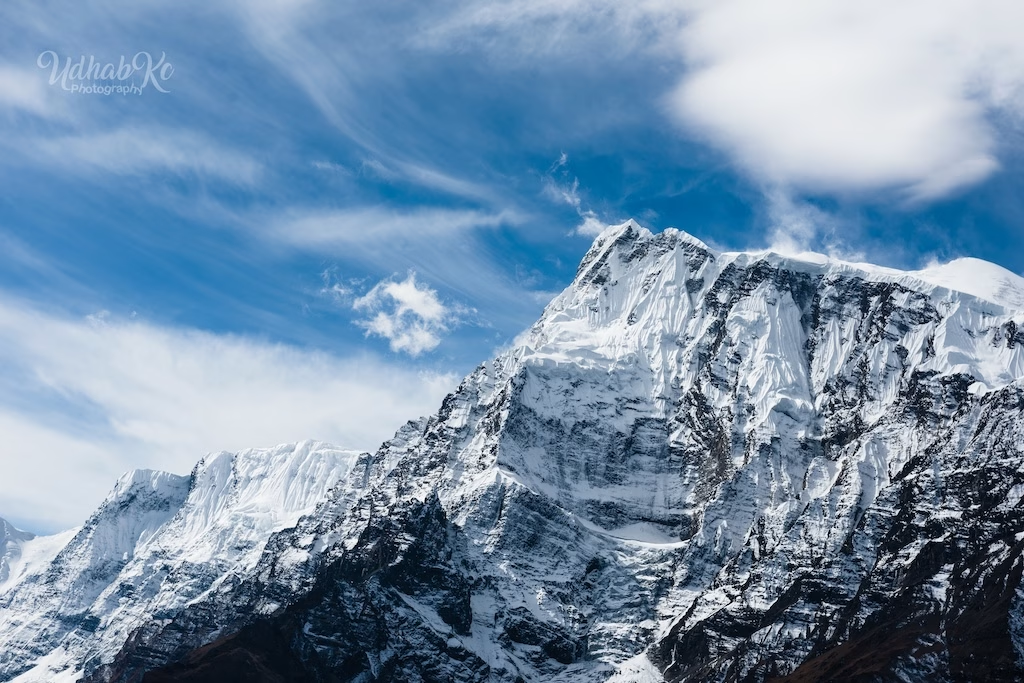
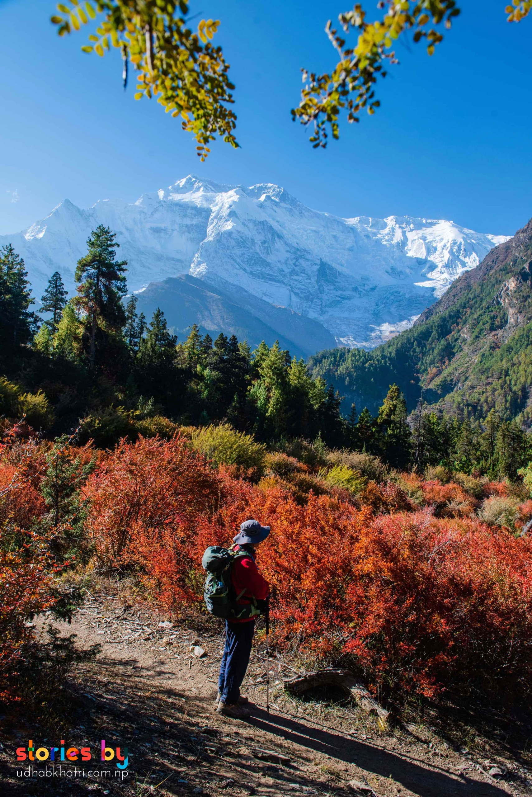
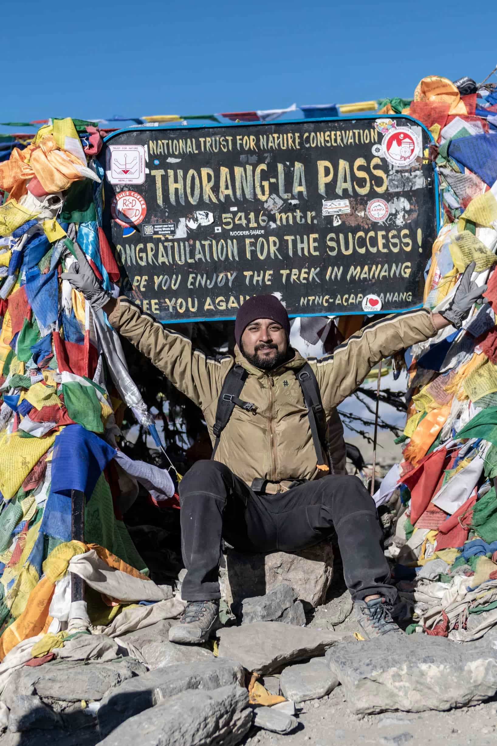
The classic route begins at Besisahar (820 m) and follows the Marsyangdi River north, rising slowly through rice terraces, pine forests, and Gurung villages like Tal and Chame. After Manang (3,519 m), the trees disappear and the landscape becomes starkly alpine. The climb to Thorong La (5,416 m) starts well before dawn; from the pass, the panorama sweeps from the Annapurnas to the Dhaulagiri massif. The descent into Muktinath — a sacred site of 108 water spouts and an eternal flame — drops you into the arid Kali Gandaki valley, a different world of whitewashed temples, apple orchards, and the deepest gorge on Earth.
From Jomsom, many fly back to Pokhara, but the trail continues south to Tatopani's hot springs, then climbs again to Poon Hill for a classic Himalayan sunrise before ending at Nayapul.
A 24‑70mm zoom handles most situations on the circuit, but you'll want a telephoto (70‑200mm) for the high passes and a fast prime (50mm) for the villages. At Thorong La, protect your batteries from the cold. Muktinath's water spouts are intimate, spiritual frames — use a medium telephoto from a respectful distance. The apple orchards of Marpha glow in late‑afternoon light; a polariser deepens the blue sky against the white walls. The descent through the Kali Gandaki gorge is a lesson in scale — include a human figure to show the immensity of the cliffs.
 Photo
Photo
 Photo
Photo
 Photo
Photo
 Photo
Photo
Manang Valley: Braga, Gangapurna & Ice Lake
Manang (3,519 m) is the natural acclimatisation hub of the circuit, but it's far more than a rest stop. The village itself is a maze of stone houses and mani walls. The ancient Braga Monastery, perched on a cliff above the valley, offers one of the finest architectural‑landscape compositions in the Annapurnas — especially at dawn, when the first light catches the cliff and the valley below remains in shadow.
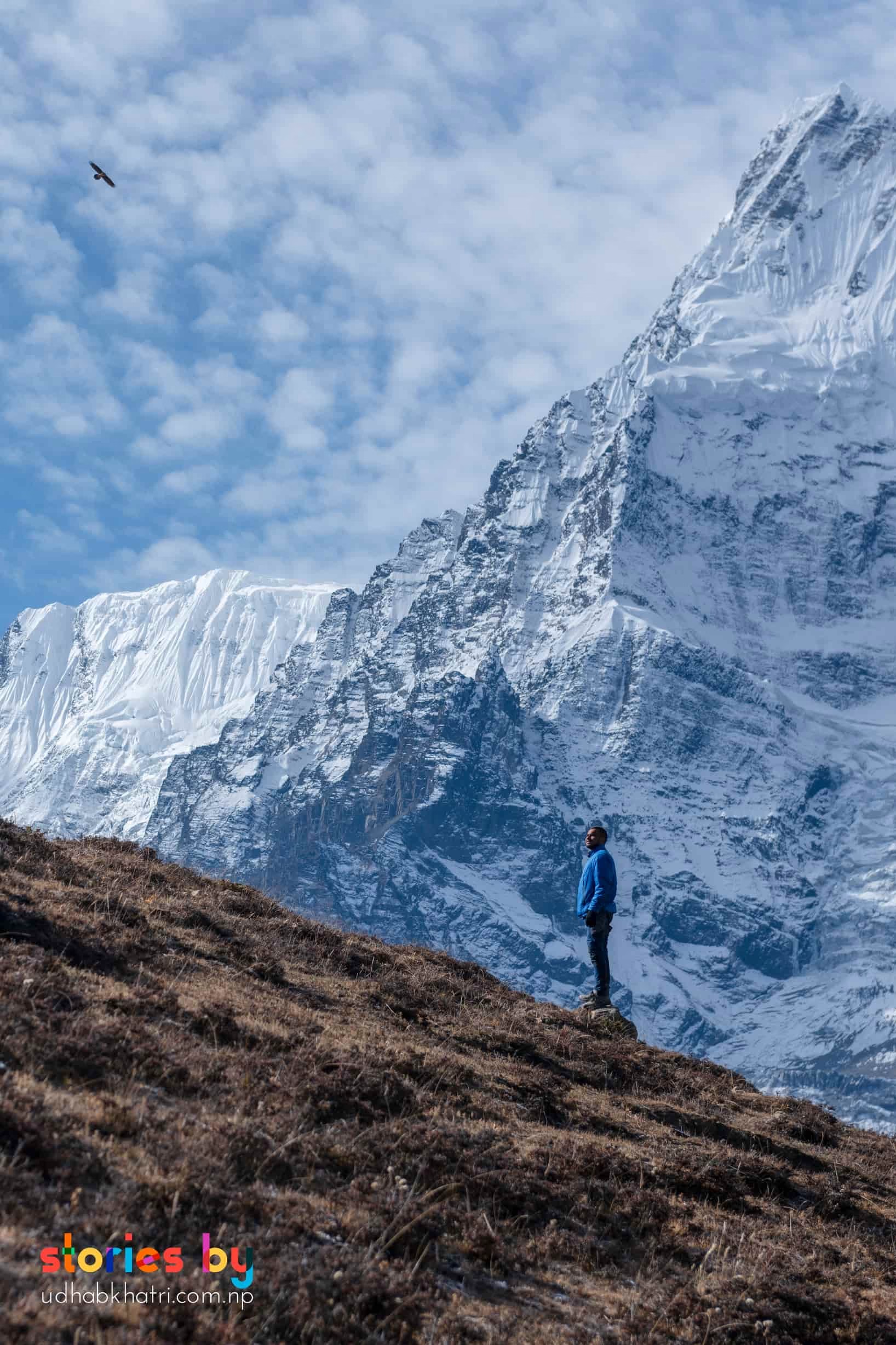
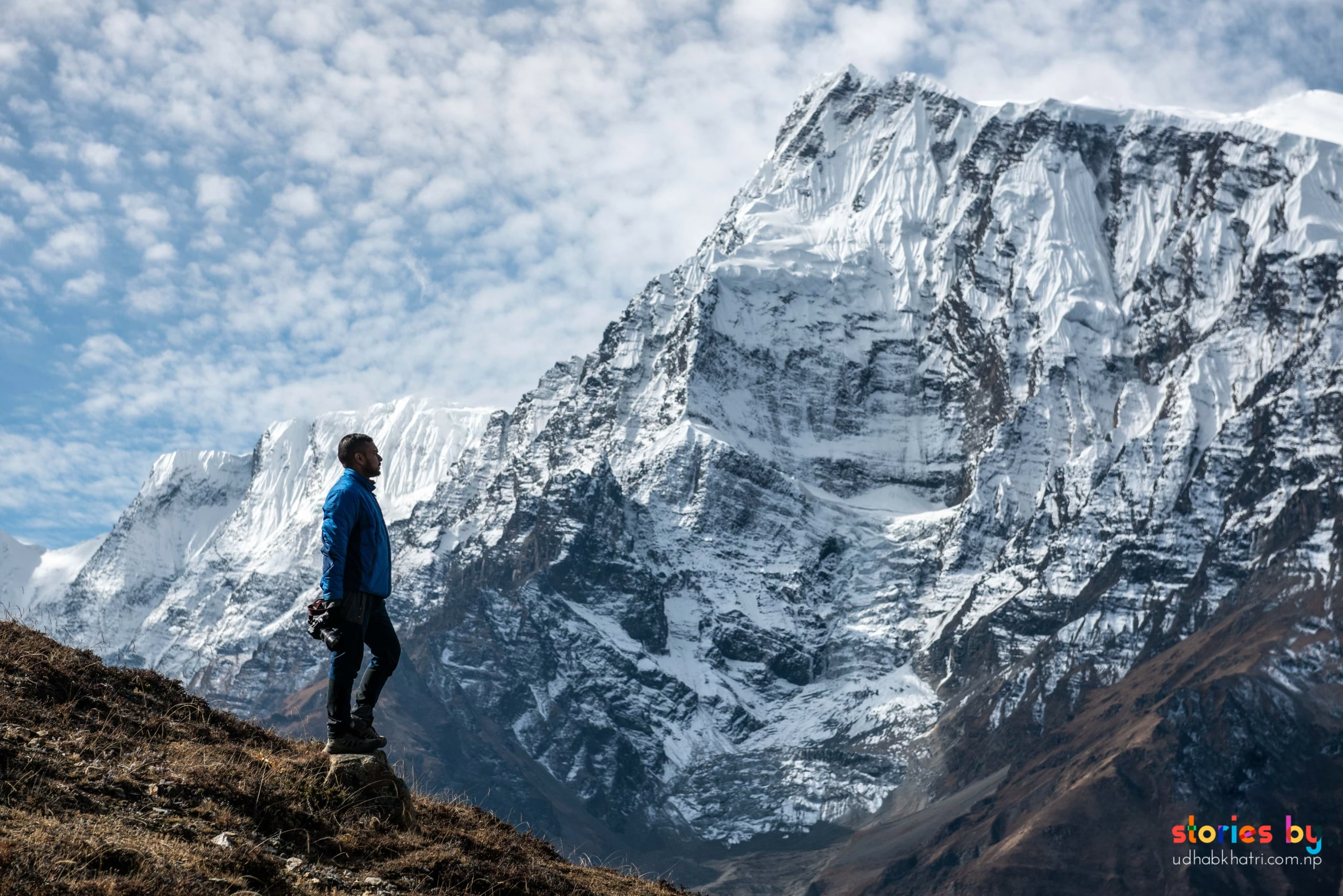
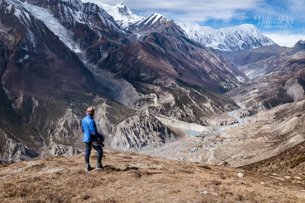
Immediately accessible from town is Gangapurna Lake, a glacial lake at the foot of the Gangapurna glacier. Its milky‑blue waters reflect the surrounding peaks and reward a tripod for long‑exposure shots that soften the meltwater. For a more demanding day hike, Ice Lake (Kicho Tal) sits at 4,620 m, a steep 4‑hour climb that opens onto a high‑altitude amphitheatre of snow and rock. The glacial water here can appear deep turquoise under clear skies — a striking contrast to the barren brown slopes.
Braga Monastery at dawn is best with a wide‑angle (24‑35mm) to capture the monastery against the vast cliff. For Ice Lake, a polarising filter cuts glare and deepens the blues. Gangapurna Lake rewards a tripod for long‑exposure shots that soften the glacial meltwater. All three locations benefit from including a human figure for scale.
Tilicho Lake (4,919 m) — One of the Highest Lakes in the World
From Manang, the trail to Tilicho Lake branches west, climbing through Khangsar village and the exposed "Tilicho landslide section." The final ascent is steep and rocky, but the reward is staggering: a vast expanse of turquoise water, frozen for much of the year, cradled beneath the north face of Tilicho Peak and the Great Barrier. At 4,919 m, it is one of the highest lakes of its size on Earth.
The lake's colour changes dramatically with the light — from deep indigo under overcast skies to brilliant cyan at midday. Morning is best for calm water and reflections. For the adventurous, the high‑altitude Mesokanto La (5,099 m) connects Tilicho directly to Jomsom, a challenging alternative to Thorong La.
The scale of the lake is hard to convey without a human element — include a trekker or a prayer flag in the frame. A telephoto (70‑200mm) isolates the textures of the glacier and the shoreline; a wide‑angle captures the full sweep. The landslide section before the lake is dramatic — use a fast shutter to freeze falling scree, or a slow one for motion blur.
Narphu, Upper Mustang & the ABC Connection
The Annapurna Circuit is a spine that connects several deeper photographic expeditions. At Koto, near Chame, the restricted Narphu Valley branches off toward the ancient villages of Phu and Nar, returning to the circuit via the Kang La pass. From Kagbeni, north of Jomsom, the restricted Upper Mustang region leads to the walled capital of Lo Manthang. And from Tatopani, a trail climbs toward Ghorepani and Poon Hill, then connects to the classic Annapurna Base Camp (ABC) trek — allowing you to combine two of Nepal's greatest walks in a single journey.
Wildlife & Peaks
The Annapurna Conservation Area shelters snow leopards, blue sheep, Himalayan tahr, and over 450 bird species. On the trail, look for lammergeiers (bearded vultures) and the flash of the Himalayan monal (danphe), Nepal's national bird. The valley is also rich in medicinal plants and alpine flowers.
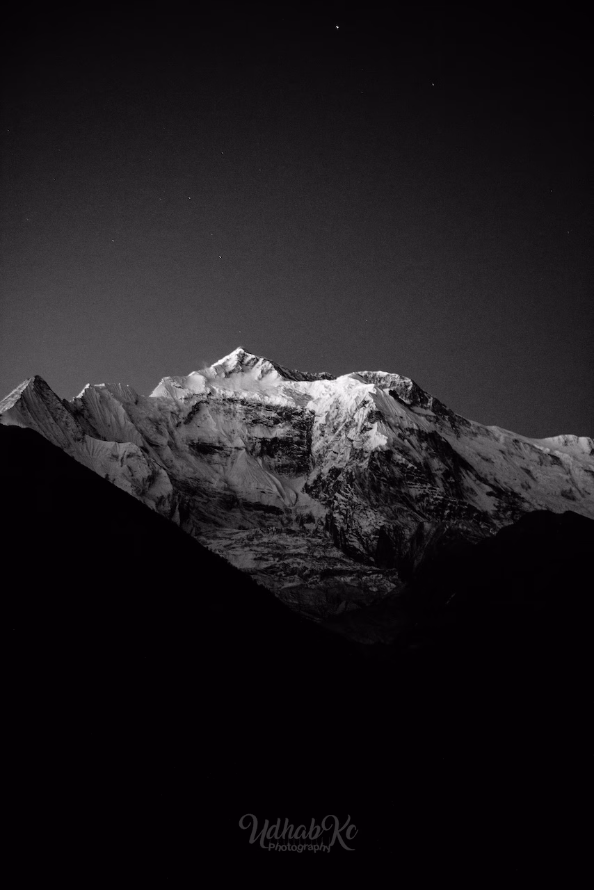
From Manang and the circuit, the skyline is dominated by Annapurna II (7,937 m), Annapurna III (7,555 m), Annapurna IV (7,525 m), Gangapurna (7,454 m), Tilicho Peak (7,134 m), and the massive Dhaulagiri range. Machhapuchhre (Fishtail) appears on the southern end near Poon Hill.
Permits & Fees
The Annapurna Circuit requires only the standard ACAP and TIMS. Manang, Tilicho, and the day hikes are all included. No restricted‑area permit is needed for the main route.
Foreigners: NPR 3,000 · SAARC: NPR 1,000
If you add Narphu or Upper Mustang, separate restricted‑area permits apply. Fees subject to change. Verify current rates before departure.
Safety on the Circuit
Thorong La exceeds 5,400 m — proper acclimatisation is non‑negotiable. Spend at least two nights in Manang and one at Thorong Phedi. The Tilicho trail includes steep, loose sections; trekking poles are strongly advised. Helicopter evacuation is possible but expensive — ensure your insurance covers high‑altitude rescue.
Read our complete trekking safety guide for Nepal. It covers acclimatisation, travel insurance, what to pack, and how to handle emergencies on the trail.
Read the safety guide →