Langtang,
the valley that rose again
Glaciers, Tamang villages, and a landscape marked by loss and resilience
Langtang is the closest high‑altitude wilderness to Kathmandu, yet it feels a world away. The valley climbs through rhododendron and bamboo forests into a U‑shaped glacial bowl ringed by peaks that graze the Tibetan border. On 25 April 2015, a massive avalanche triggered by the earthquake buried the old Langtang Village, taking hundreds of lives and erasing a community that had existed for centuries. Today the valley has rebuilt — a new Langtang Village sits slightly higher up — and the trails are open, quiet, and profoundly photogenic. For a documentary and landscape photographer, Langtang offers a rare combination: raw natural beauty layered with the visible memory of catastrophe and recovery.
Syabrubesi to Kyanjin Gompa
The trek starts at Syabrubesi, reachable by bus from Kathmandu in about 7–8 hours. The trail follows the Langtang Khola river through a narrow, forested gorge. The first days pass through oak and bamboo, with langur monkeys often visible in the canopy. After Ghoda Tabela the valley opens dramatically — the trees retreat, and the white‑capped peaks of Langtang Lirung (7,227 m) dominate the horizon.
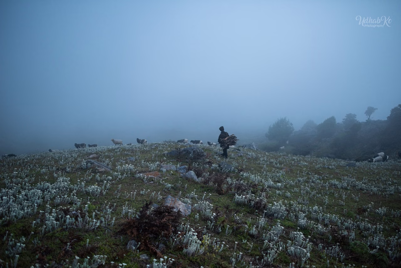
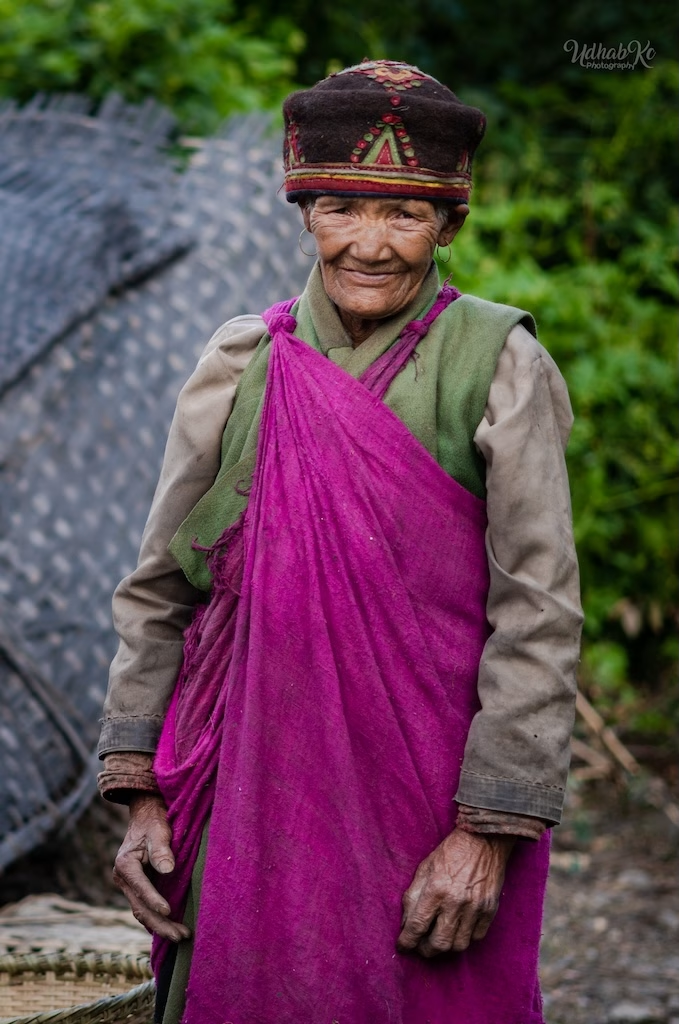
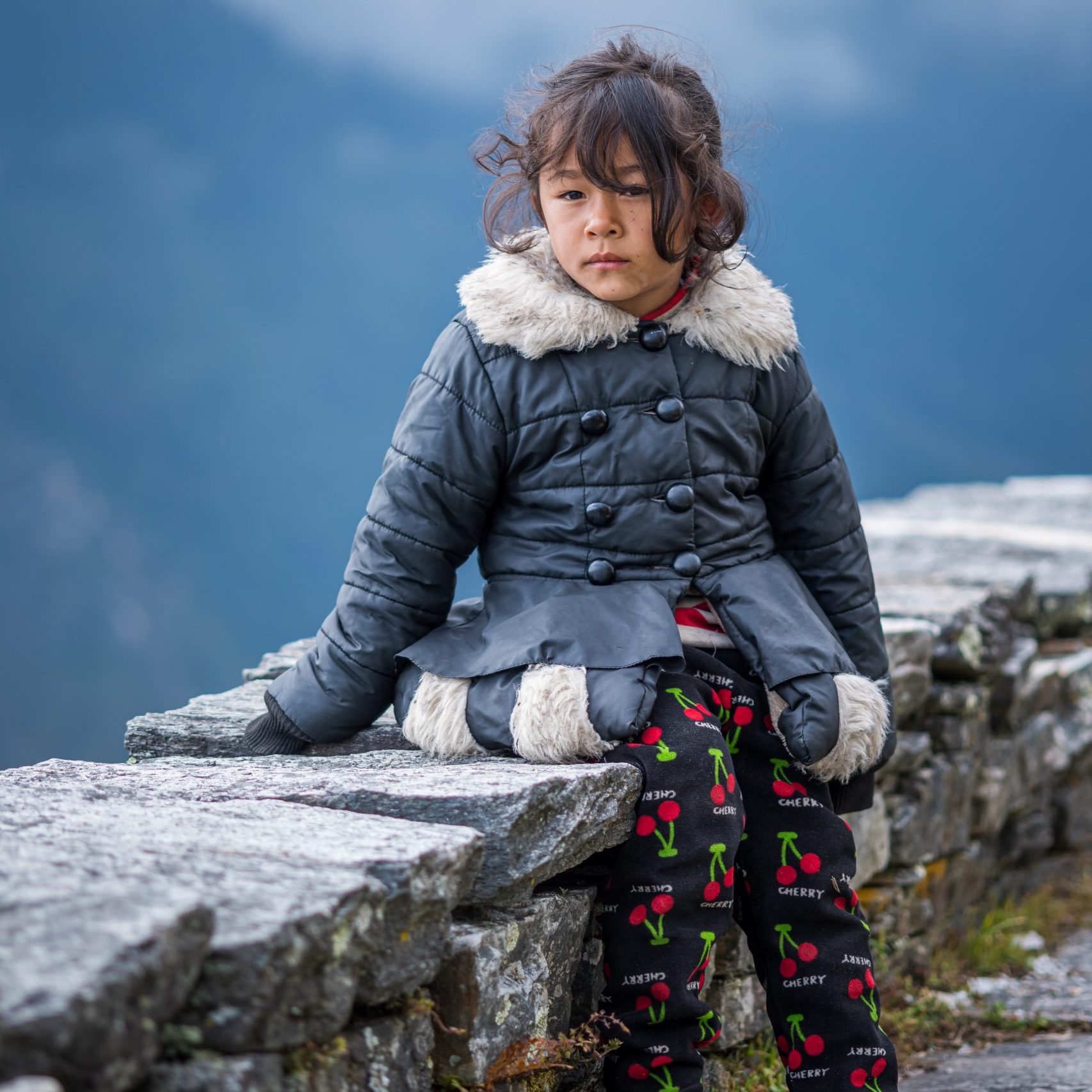
The Tamang people who live here have a distinct Tibetan‑influenced culture, visible in their carved wooden houses, their dress, and the monasteries that dot the route. The side trail to Tamang Heritage Trail — an alternative cultural route beginning at Syabrubesi and joining the main Langtang trail — offers intimate portraits and a slower, community‑based experience. It's well worth a day or two for photographers interested in village life.
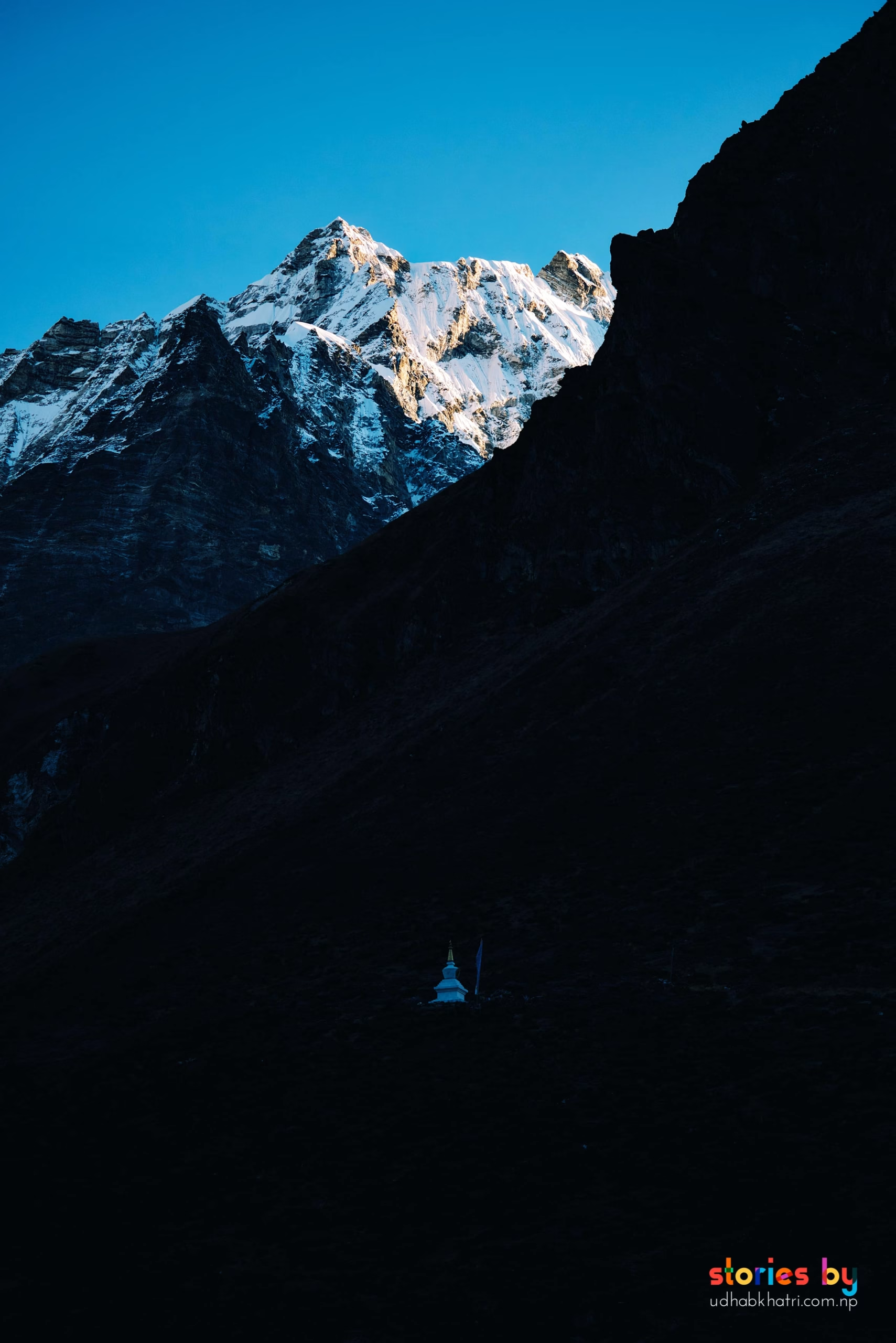
The destination is Kyanjin Gompa (3,870 m), a small monastery surrounded by a cirque of peaks. The light here, especially at dawn, is extraordinary — the first rays hit the ice and reflect into the valley, creating a soft, luminous quality that feels almost alpine.
The lower gorge is dark and moody; a 24‑70mm handles the changing light. As the valley opens, switch to a telephoto (70‑200mm) to isolate the peaks and the monastery against the sky. The Tamang Heritage Trail is excellent for environmental portraits — use a 35mm or 50mm prime and take your time. The new Langtang Village, rebuilt above the old site, carries a quiet, poignant atmosphere — photograph it with sensitivity, not spectacle.
Kyanjin Ri, Tserko Ri & the Red Panda Forest
From Kyanjin Gompa, two peaks offer spectacular sunrise views. Kyanjin Ri (4,773 m) is the more accessible of the two — a steep but short climb that rewards with a 360‑degree panorama of the Langtang range and the valley below. Tserko Ri (4,984 m) is a more demanding ascent, but the extra effort is repaid with an even grander view and a sense of true high‑altitude solitude. Start both hikes well before dawn to catch the first light on the peaks.
The forests between Ghoda Tabela and Kyanjin are also one of the best places in Nepal to spot the endangered red panda. These shy, bamboo‑munching animals are most active in the early morning and late afternoon. A telephoto (at least 200mm) is essential, but patience is the real tool — sit quietly at the edge of a bamboo grove and wait. Even if you don't see one, the search adds a layer of quiet expectation to the trek.

For sunrise, a wide‑angle (16‑35mm) captures the full panorama, while a telephoto isolates the golden light hitting specific peaks. Bring warm layers — the wind at 5,000 m is biting, even before dawn. A sturdy tripod or a stable rock will help with long‑exposure shots of the glacial streams. For red pandas, manual focus and a silent shutter will prevent startling them. The bamboo forests themselves, with their filtered light, make beautiful environmental images even without wildlife.
 Photo
Photo
 Photo
Photo
 Photo
Photo
 Photo
Photo
Ganja La Pass & the Gosaikunda Connection
For trekkers who want to extend the Langtang experience, two distinct routes branch off. Ganja La Pass (5,130 m) is a difficult, technical crossing that links Langtang to the Helambu region. It requires mountaineering equipment and a guide, but the photographic rewards — the high‑altitude desolation, the ice‑encrusted prayer flags, the sense of achievement — are immense.
Alternatively, the trail to Gosaikunda (a sacred alpine lake at 4,380 m) can be reached from the lower Langtang valley via a connecting path through the forest. Gosaikunda is a major pilgrimage site, and its still, milky‑blue waters framed by snow peaks create some of the most serene landscape compositions in the region. The best light falls at dawn, when the lake is calm and the surrounding peaks turn pink.
Ganja La demands preparation: crampons, rope, and a clear weather window. The pre‑dawn ascent in snow creates ethereal, monochromatic scenes — shoot in RAW to preserve the subtle tonal variations. Gosaikunda's still water is a natural mirror; use a polarising filter to control reflections, and include a human figure or a prayer flag for scale. Both places are cold — keep spare batteries inside your jacket.
Permits & Fees
Langtang requires a national park entry permit and a TIMS card. No restricted‑area permit is needed.
SAARC: NPR 1,500
Both permits can be obtained at the tourism office in Kathmandu. No guide is legally required, though one is recommended for Ganja La. Fees subject to change.
Safety in Langtang
Kyanjin Ri and Tserko Ri reach almost 5,000 m — altitude sickness is a real risk. Ascend gradually and take a rest day at Kyanjin Gompa. Ganja La is a technical pass; do not attempt it without proper equipment and an experienced guide. The valley is also in a seismically active zone; while the trails are safe, be aware of the landscape's recent history and listen to local advice.
Read our complete trekking safety guide for Nepal. It covers acclimatisation, travel insurance, what to pack, and how to handle emergencies on the trail.
Read the safety guide →