Narphu,
the valley beyond the pass
A hidden corridor of ancient Tibetan culture, crumbling chortens, and high desert silence
The Narphu Valley is one of Nepal's most restricted and rarely visited trekking areas. Tucked between the Annapurna and Manaslu massifs, the twin villages of Nar and Phu preserve a centuries‑old Tibetan Buddhist way of life. The trek crosses the 5,306 m Kang La pass, which opens onto the Manang valley and the Annapurna Circuit — a route few photographers have the privilege to document. This is a landscape of ochre cliffs, ancient monasteries, and wind‑scoured prayer flags, where every frame carries the weight of solitude.
From Koto to Nar, Phu & Kang La Pass
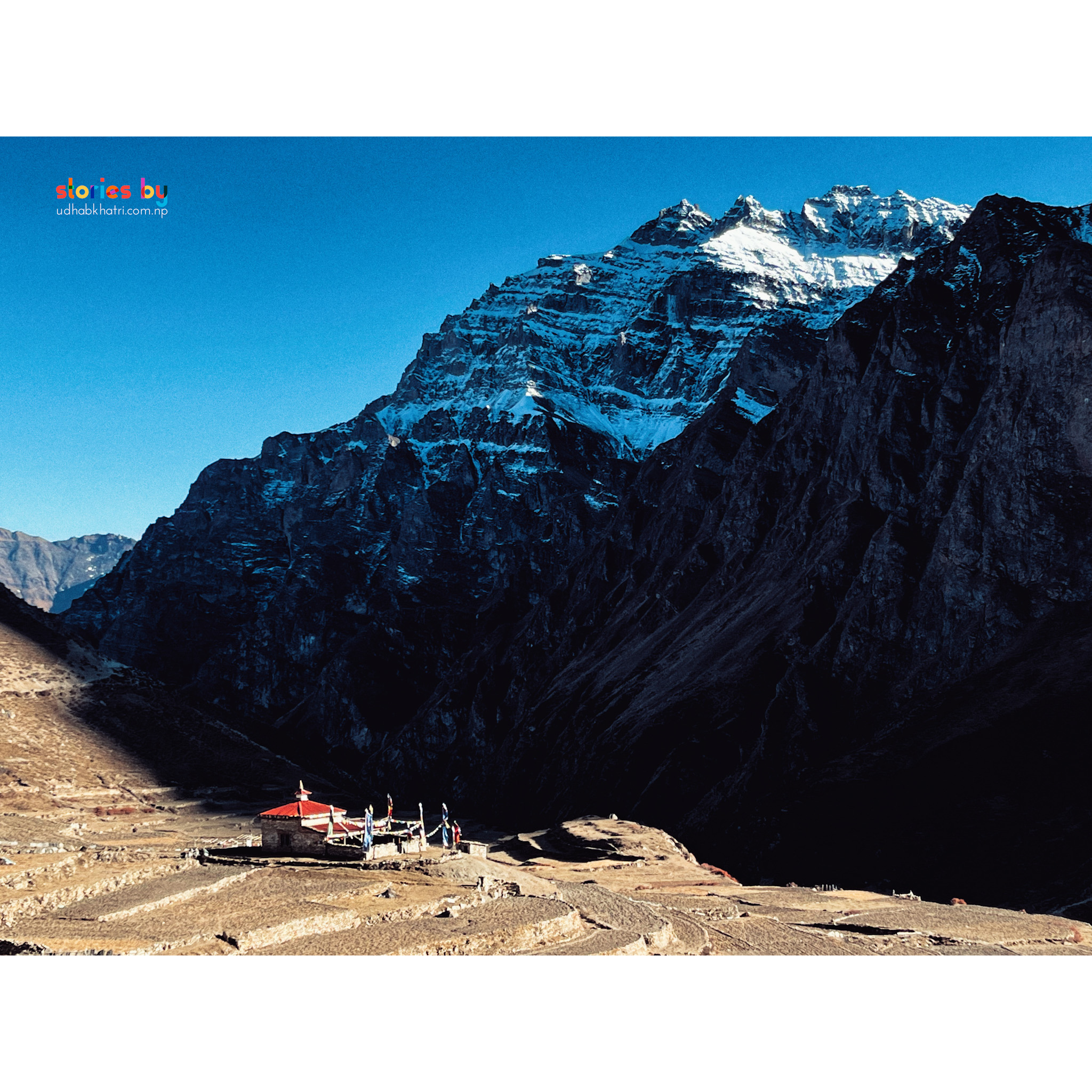
The trek begins at Koto, a small village on the Annapurna Circuit trail near Chame. From there, the path climbs steeply into a narrow, forested gorge, emerging into a high‑altitude desert of ochre rock formations and ancient chortens. Phu (4,080 m) is the first village, crowned by the hilltop Tashi Lhakhang monastery. Nar (4,110 m) follows a day later, with its maze of stone houses and the Lo Gekar Gompa — one of the oldest monasteries in the region.
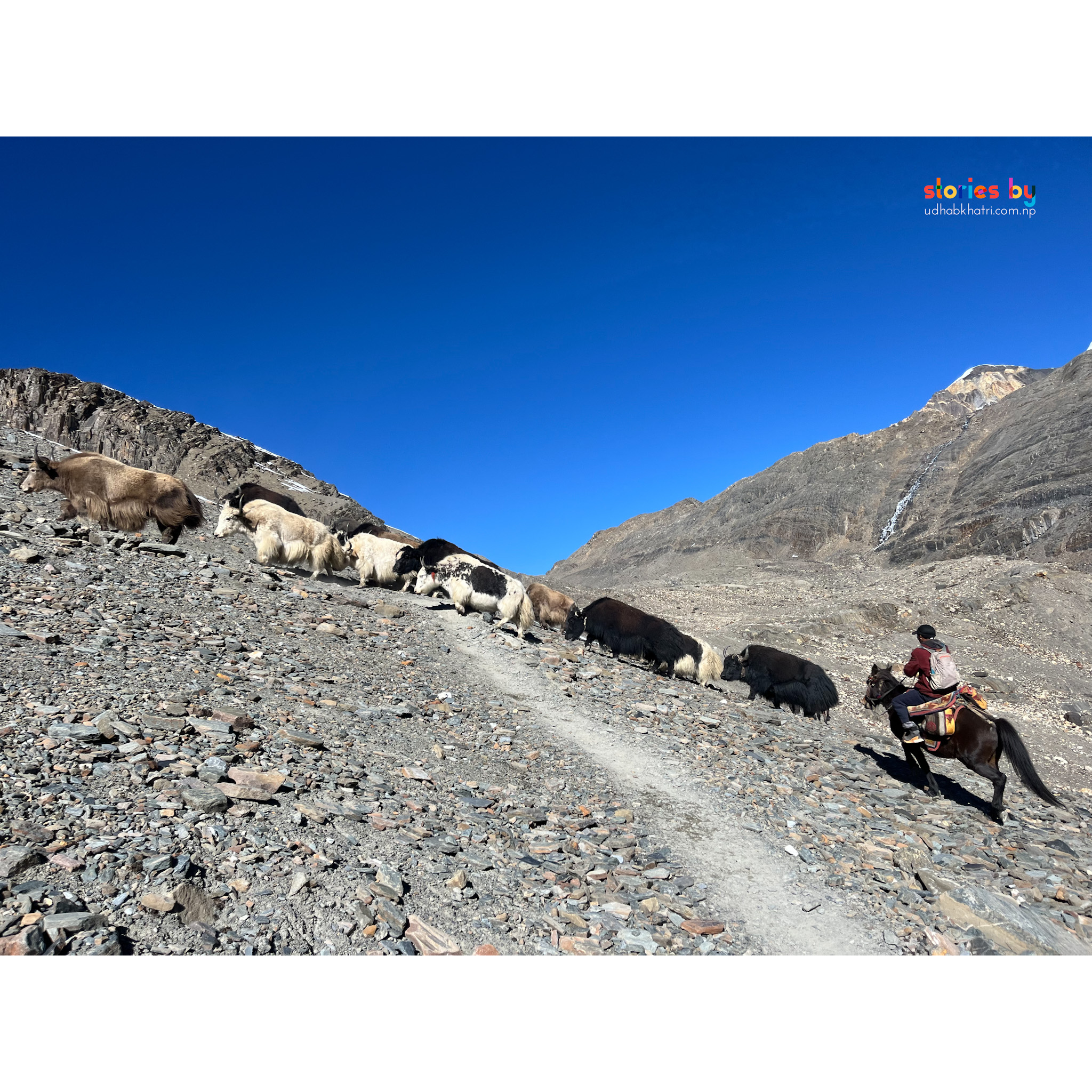
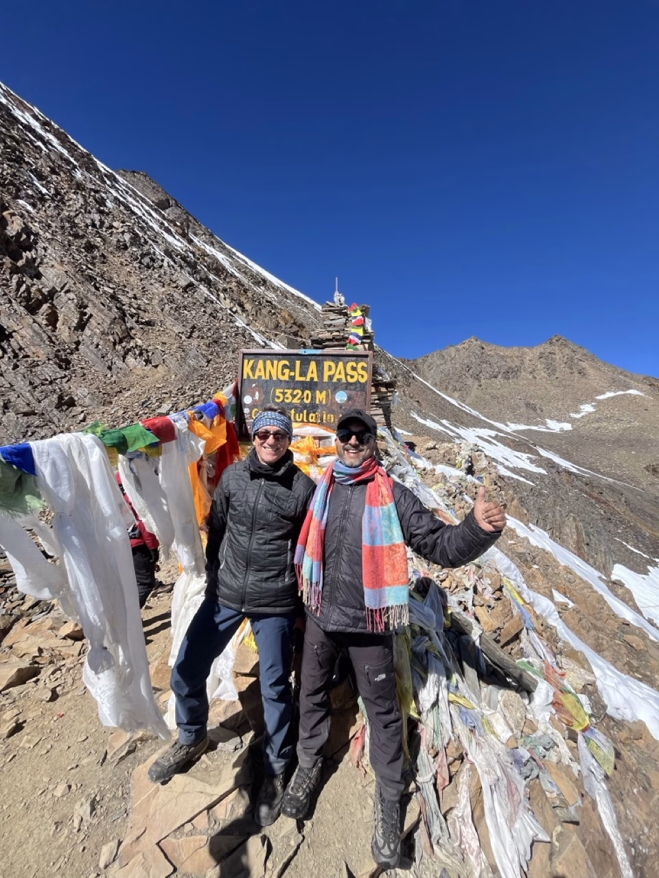
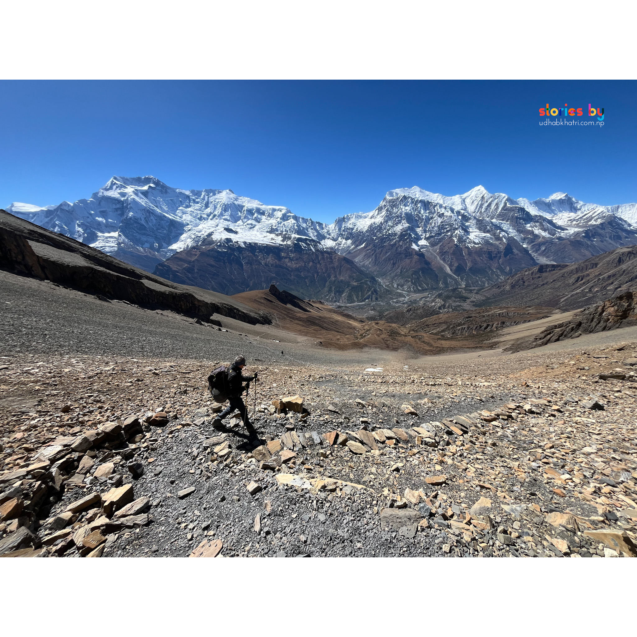
The climax is Kang La Pass (5,320 m), a demanding crossing that rewards with panoramic views of the Annapurna range. The trail then drops sharply into Manang, where trekkers can rest before continuing on the Annapurna Circuit — either toward Thorong La to complete the full loop, or back down the Marsyangdi valley toward Besisahar.
The valley's muted palette — ochre, grey, deep blue — creates a natural colour harmony. A telephoto (70‑200mm) compresses the layered rock formations against distant snow peaks. In the villages, a 35mm or 50mm prime captures the textures of ancient walls and the faces of elders who have rarely been photographed. The monasteries' interiors are dark; a fast lens (f/1.4–f/1.8) is essential. At Kang La, a wide‑angle (16‑35mm) emphasises the scale of the pass and the sweep of the surrounding peaks. Start early to avoid afternoon clouds.
 Photo
Photo
 Photo
Photo
 Photo
Photo
 Photo
Photo
Into Manang & the Annapurna Circuit
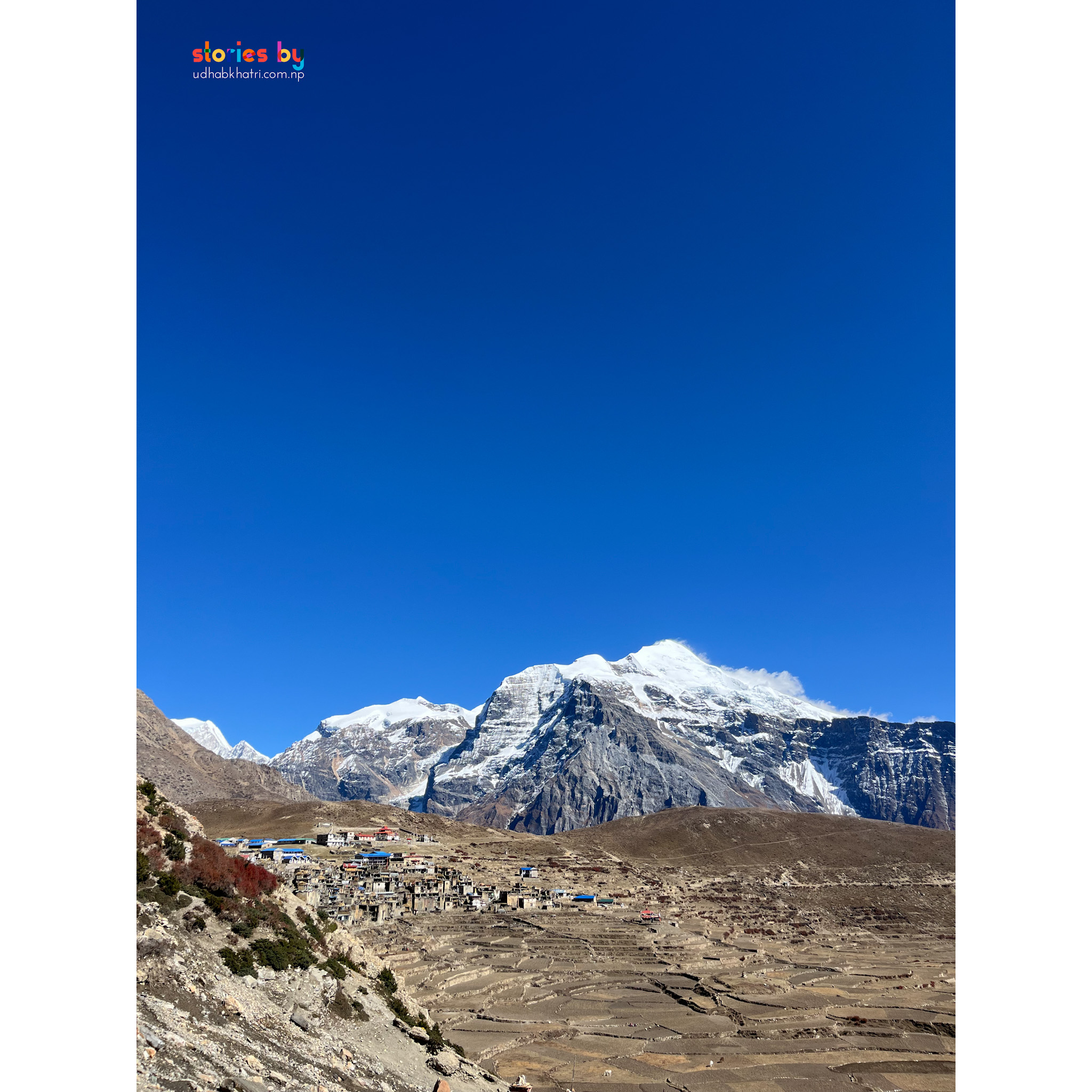
After descending from Kang La, you arrive in Manang (3,519 m), a classic stop on the Annapurna Circuit. From here you have two excellent photographic options: continue north toward Thorong La (5,416 m) and Muktinath to complete the full circuit, or take the quieter route south through the Marsyangdi valley, with views of Annapurna II, III, and Gangapurna. Either way, the Narphu trek adds a profound, off‑the‑radar dimension to one of the world's great trekking routes.
Permits & Fees
The Narphu Valley is a restricted area. A special permit and a registered guide are mandatory.
Mandatory · Guide required
Foreigners: NPR 3,000
Permits must be arranged through a registered trekking agency. Fees subject to change. Verify current rates before departure.
Safety in the Narphu Valley
Kang La Pass exceeds 5,300 m, and the trail includes steep, exposed sections. Proper acclimatisation is essential. The valley is extremely remote; evacuation is difficult and expensive — make sure your travel insurance covers high‑altitude helicopter rescue.
Read our complete trekking safety guide for Nepal. It covers acclimatisation, travel insurance, what to pack, and how to handle emergencies on the trail.
Read the safety guide →