Mustang,
the hidden kingdom
Where the wind carves the valley and the light paints the cliffs
Mustang is a land of deep contrasts. Lower Mustang, accessible without special permits, winds through the Kali Gandaki valley between apple orchards, whitewashed villages, and sacred shrines. Upper Mustang, restricted and remote, leads to Lo Manthang — the walled capital of an ancient Tibetan kingdom. Both halves share the same immense sky and the same feeling of having stepped into another world. For a photographer, the entire region is a study in light, texture, and the relationship between arid landscape and human resilience.
The Kali Gandaki Valley: Jomsom, Marpha, Muktinath

Jomsom is the gateway to Mustang — a windy administrative centre with a small airport and a wide riverbed. Just outside town sits Dhumba Lake, a turquoise body of water with Nilgiri reflected on its surface. The best photographs come in the morning, before the wind roughens the water and the mountain doubles perfectly.
Marpha is the valley's most photogenic village: cobbled lanes, whitewashed houses, and apple orchards that contrast sharply with the arid surroundings. Its narrow alleyways are best in the early morning when the light skims the walls and creates deep, graphic shadows.
Muktinath is a sacred site for both Hindus and Buddhists. Its 108 water spouts and an eternal flame draw pilgrims from across Nepal. If you are coming from the Annapurna Circuit, after crossing Thorong Pass (5,416 m) you descend directly behind the Muktinath temple — a place of rest and renewal after the hardest stage of the trek.
Lupra, a small and often overlooked village, houses a 12th‑century Bonpo monastery and unique flat‑roofed architecture rarely seen elsewhere in the valley.
At Dhumba Lake, use a wide‑angle (24mm) to capture the full reflection of Nilgiri at sunrise. In Marpha, a 35mm or 50mm prime isolates the textures of white walls and wooden windows. At Muktinath, a 70‑200mm lets you photograph pilgrims under the water spouts from a respectful distance without intruding on their devotion.

Villages Between Marpha and Tatopani
The path down the Kali Gandaki passes through hamlets worth a pause: Tukuche, a Gurung village with a large monastery and Dhaulagiri looming behind; Kalopani / Lete, at the deepest point of the gorge where mountain walls rise on both sides; and Ghasa, a settlement among pine forests known for its birdlife. Each offers quiet, wide‑angle landscape opportunities where the scale of the mountains dwarfs the human presence.
From Tatopani to the Annapurna Sanctuary
At Tatopani (literally "hot water") you can rest in natural hot springs and decide whether to continue south or change direction. From here a trail climbs toward Ghorepani and the famous Poon Hill viewpoint, then joins the classic ABC (Annapurna Base Camp) route at Chhomrong. This allows you to combine a Lower Mustang trek with one of the most iconic Himalayan walks in a single continuous journey.
Lo Manthang & the Forbidden Kingdom

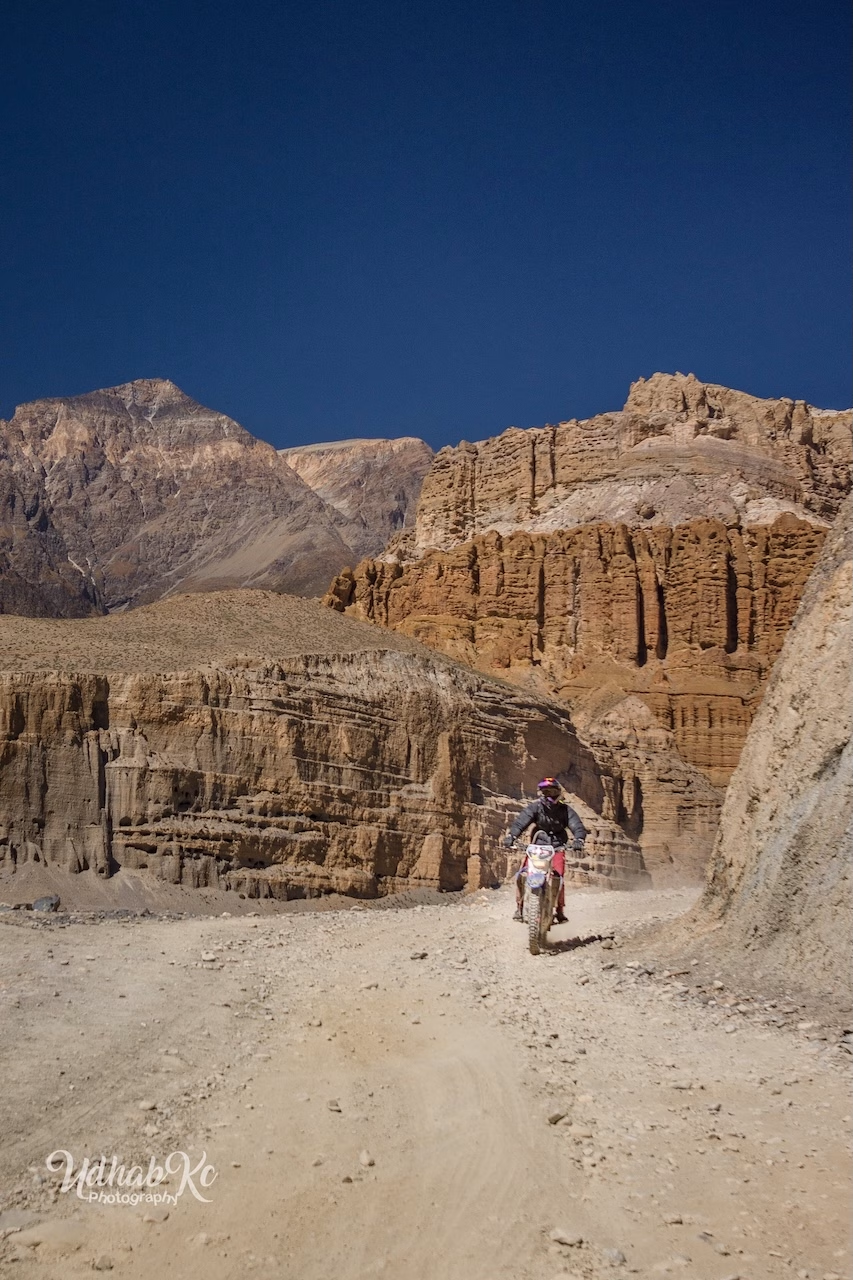
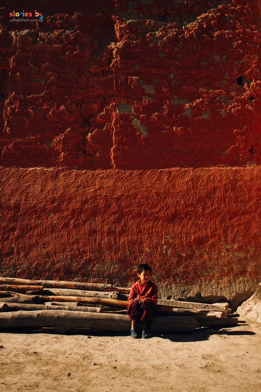
Beyond Kagbeni, the landscape transforms into a high‑altitude desert dotted with cave monasteries and fortified villages. Lo Manthang, the walled capital of the ancient kingdom, is the final destination: dirt streets, the king's palace, and the monasteries of Thubchen and Jampa. If your visit coincides with the Tiji Festival (May), you'll witness masked ritual dances symbolising the victory of good over chaos — an extraordinary photographic subject.
Upper Mustang is a restricted area: a registered guide is mandatory, and you must travel in a group of at least two. The restricted permit costs USD 500 for 10 days and helps preserve the region's fragile culture and environment.
The ochre cliffs and deep blue sky create a natural colour palette. Use a telephoto (70‑200mm) to compress the layered rock formations, and a wide‑angle (24mm) to capture the scale of the desert with a figure for context. The monasteries' interiors are dark; a fast prime (35mm f/1.4) will help you work with the available light. During Tiji, position yourself at the edge of the ceremonial ground and use a 70‑200mm to isolate the masked dancers against the bare landscape.

 Foto
Foto
 Foto
Foto
 Foto
Foto
 Foto
Foto
Permits & Fees
Lower Mustang requires only the ACAP permit. Upper Mustang requires an additional restricted‑area permit and a mandatory guide.
Foreigners: NPR 3,000 · SAARC: NPR 1,000
Required only for Lo Manthang and surroundings
Permits must be arranged through a registered agency. Fees are subject to change. Verify current rates before departure.
Safety in Mustang
Average elevations range from 2,800 m to over 4,000 m. Upper Mustang involves no technical passes, but acclimatisation remains essential. The wind can be relentless — protect your gear and your skin.
Read our complete trekking safety guide for Nepal. It covers acclimatisation, travel insurance, what to pack, and how to handle emergencies on the trail.
Read the safety guide →